
地面端態勢可視化平台
1. Project Background
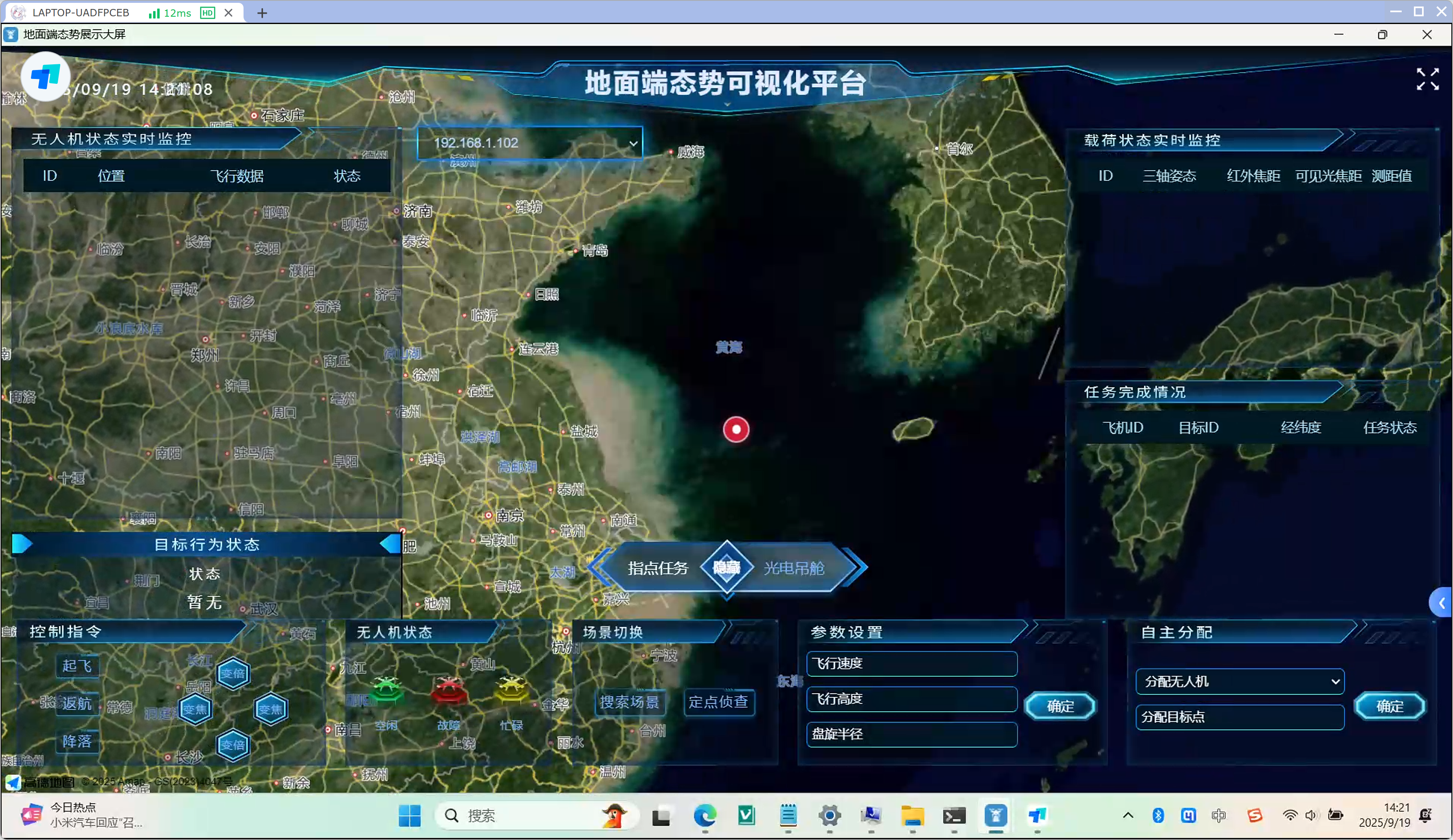
With the large-scale application of UAVs in sea area management, security patrol, emergency response and natural resource inspection, there are prominent management pain points during multi-UAV simultaneous operations, such as scattered situation display, isolated data, unintuitive scheduling and cumbersome remote control procedures. To realize unified command of UAV clusters, full-domain situational awareness and intelligent task collaboration, the Ground Terminal Situation Visualization Platform is developed. It connects data links among UAVs, airborne photoelectric payloads and ground command terminals, builds an integrated visualized command center based on maps, and forms a full-process UAV management system with the capacity of real-time monitoring, effective control and flexible scheduling.
2. Core Functional Modules
(1) Full-Domain Map Situation Overview
Based on high-precision electronic maps covering land and sea national geographic road networks, the platform intuitively marks real-time UAV positions and mission target points, enabling global overview of multi-aircraft distribution, operation areas and onshore/offshore target locations with one-map visualized situation display.
(2) Real-time UAV Status Monitoring Panel
The top-left monitoring panel lists each UAV’s ID, geographic location, complete flight data and online status. UAVs on the map are distinguished by different color markers to quickly identify online/offline, working/standby equipment status.
(3) Real-time Airborne Payload Data Feedback
The right payload monitoring module parses operating parameters of photoelectric pods in real time, including three-axis attitude, infrared focal length, visible light focal length and laser ranging values. Raw data from airborne sensors are synchronously transmitted to monitor the working status of reconnaissance equipment.
(4) Full Lifecycle Mission Management
- Mission Archive Recording: Record aircraft ID, target ID, target longitude & latitude and real-time task status for every operation to form complete traceable mission ledgers;
- Target Behavior Monitoring: Capture dynamic target data in real time, mark abnormal targets and support early warning tracking;
- Scene Switching: Support area search and one-click switch to fixed-point reconnaissance mode for rapid patrol scene conversion.
(5) Remote Command Issuance
The left command area integrates remote control orders including takeoff, return, landing, direction adjustment and optical zoom. Commanders can send flight control instructions without page switching to adjust UAV flight attitude and reconnaissance operations in real time.
(6) Custom Flight Parameter Configuration
An independent parameter panel allows users to customize flight speed, operation altitude and circling radius. Configurations can be sent to UAVs with one click to adapt to reconnaissance missions in complex low-altitude environments such as offshore sea areas and mountainous land.
(7) Autonomous Intelligent Multi-UAV Scheduling
The autonomous allocation module realizes intelligent task decomposition: users can manually assign UAVs and bind patrol target points. The system supports multi-aircraft collaborative operations and automatically matches UAVs with reconnaissance tasks to improve cluster scheduling efficiency.
3. Project Value
- Full-domain Visualized Situation: Data of multiple UAVs, airborne payloads and ground targets are converged on a unified geographic map, eliminating scattered multi-window viewing and enabling commanders to grasp all operation dynamics in one interface.
- Integrated Remote Operation: Flight control, payload adjustment, task scheduling and parameter configuration are integrated on a single platform to shorten command links and speed up emergency response.
- Intelligent Multi-UAV Collaboration: The autonomous allocation mechanism supports parallel cluster operations, realizing synchronous zonal reconnaissance for large sea areas and long-distance security patrols.
- Traceable Full-process Data: UAV flight logs, sensor payload data and mission records are permanently stored to meet the demands of supervision review, mission recap and safety audit.
- Multi-scenario Universal Adaptation: Applicable to diversified low-altitude operation scenarios including offshore sea supervision, border security patrol, forest fire prevention inspection, urban emergency reconnaissance and natural resource land survey.
相關案例

A hospital's logistics operation and maintenance management system
This project is an integrated smart logistics digital management platform built for modern general hospitals. It adopts a unified login portal integrating four core modules: Operation & Maintenance BIM Visual System, Logistics Operation Management System, Security Management BIM System and Work Order System. Based on a full-professional 3D BIM digital twin model of the hospital, the platform integrates capabilities including electromechanical pipeline viewing, equipment monitoring, energy consumption control, environmental quality supervision and medical supporting management. Meanwhile, it covers full-process logistics businesses such as maintenance, inspection scheduling, asset contracts, fixed assets, uniform management and quotation. It realizes visualized hospital building space, online equipment maintenance and standardized logistics workflows, solving pain points of traditional hospital logistics such as inefficient drawing retrieval, slow repair request circulation, scattered equipment ledgers and weak energy consumption control. It provides digital support for refined, intelligent and integrated operation of hospital logistics.

Robot dog inspection system
Traditional manual inspection suffers low efficiency, high risks and untraceable data. Our self-developed quadruped robot inspection management system adopts four-legged robots to cover equipment monitoring, EHS management and material transport. It realizes full digital operation & maintenance, cuts costs, improves efficiency and builds an unattended intelligent inspection system.
收一站
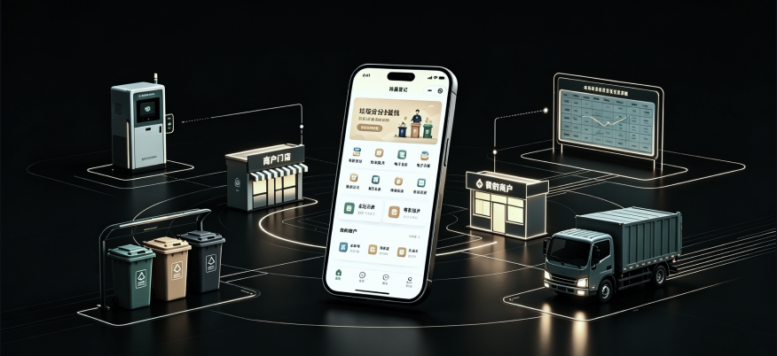
This mini-program is a weighing management system for merchants under the Garbage Sorting Experience Center, consisting of two operation modules: Administrator Portal and Merchant Portal. Designed for shopping mall stores, street vendors and garbage sorting operation staff, it realizes digital registration, weight statistics and data traceability for the whole process of merchant waste delivery. After logging in, administrators can input waste delivery weight, scan exclusive merchant QR codes to bind merchant information, upload on-site delivery photos, and archive delivery records with one click. The system supports monthly summary reports of all merchants’ delivery data, displaying the total monthly waste weight of each merchant, with flexible filtering by year and month for data review. Merchants can generate or refresh their exclusive identification QR codes, and independently check their monthly weighing & delivery records for self-verification of waste delivery ledgers. Basic management functions including merchant unbinding and QR code refresh are available. As a lightweight WeChat mini-program with no installation required, it is easy for operation staff and merchants to operate, perfectly matching scenarios such as offline waste collection, merchant garbage sorting assessment and environmental ledger filing.